Facts About Castle Rock
Castle Rock was founded in 1874 when the eastern Douglas County border was redrawn to its present location.
The town is named for the prominent, castle-shaped butte near the centre of town.
The estimated population of Castle Rock is 73,158, as of 2020, a 51.68% increase since 2010.
Castle Rock is a part of the Denver-Aurora-Lakewood, CO Metropolitan Statistical Area and the Front Range Urban Corridor.
Castle Rock is located at 39°22′20″N 104°51′22″W at an elevation of 6,224 feet, above sea level.
Castle Rock’s open spaces and parks comprise 27% of the town’s total land area of parks and open space.
The town had a total area of 21,946 acres, all of its land.
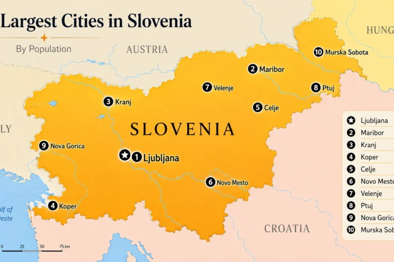
Castle Rock is the most populous Colorado town and the 16th most populous Colorado municipality.
Castle Rock was incorporated on April 14, 1881.
The town lies a few miles east of the Rampart Range of the Rocky Mountains on the western edge of the Great Plains.