Key takeaways
- Demerara River
- Demerara Toponymy
- River Transportation
Demerara River
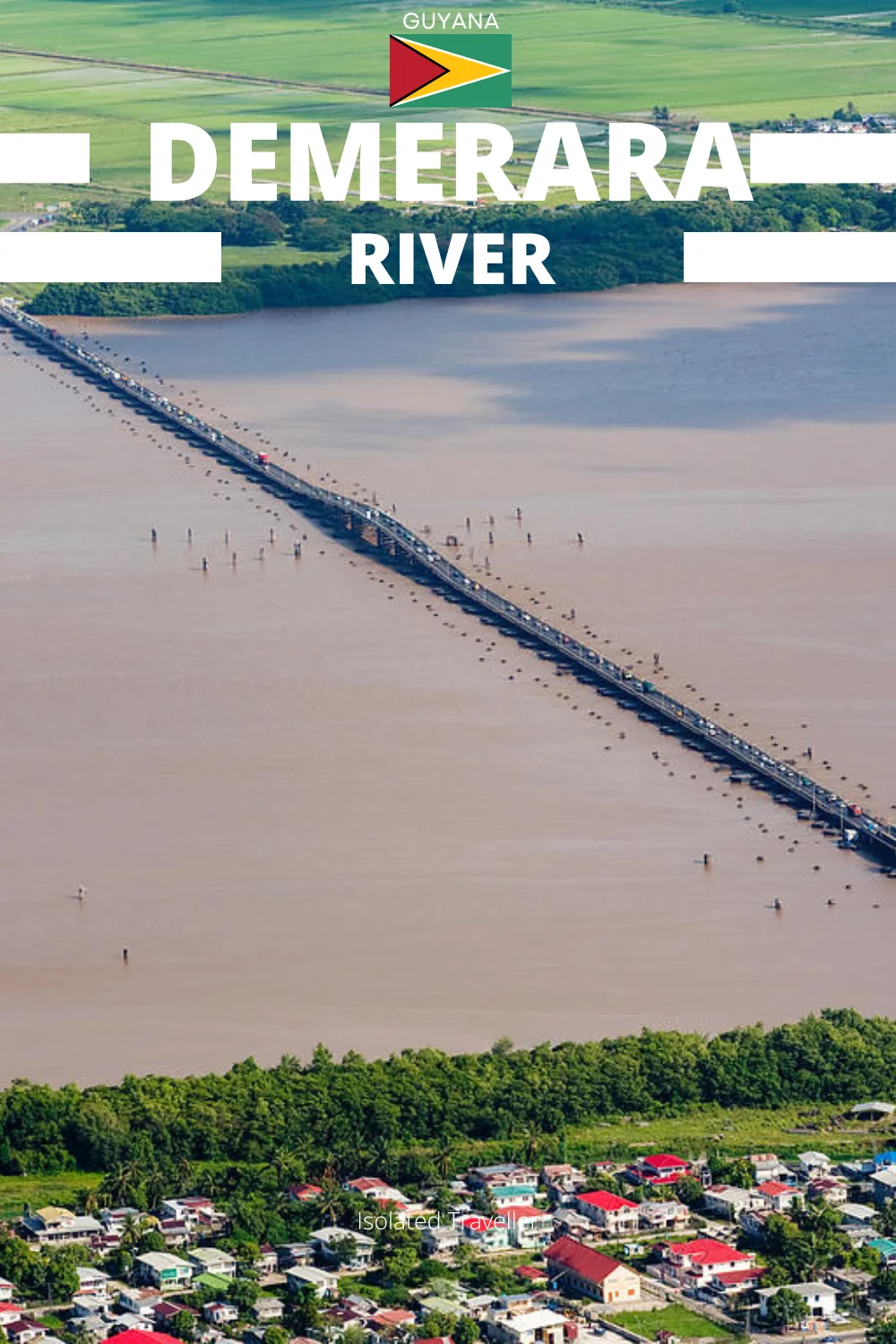
The Demerara River is one of the major rivers in Guyana, spanning 346 kilometres. Originating in the central highlands, it flows through lush rainforests and connects remote plantations to urban centres like Georgetown.
The Demerara River acts as a natural boundary, dividing the Essequibo Islands-West Demerara region, located on the west bank, from the Demerara-Mahaica region, situated on the east bank.
The river’s distinct deep brown hue is predominantly due to the substantial amounts of silt transported downstream by the strong currents. The currents are powerful enough to maintain the brown hue of the Demerara River in the ocean for a significant distance from where the river meets the sea.
The Demerara River is fed by several tributaries, among them are the Haiama River, Kuruabaru River, Haiakwa Creek, and Haianari Creek.
Demerara Toponymy
The term “Demerara” originates from a variation of the Arawak term “Immenary” or “Dumaruni,” signifying “river of the letter wood”, referring to the wood of the Brosimum Guyanese tree.
River Transportation
Due to its width and depth, the Demerara River accommodates oceangoing vessels weighing up to 5,000 tons, enabling navigation up to Linden, situated 105 kilometres from the river mouth.
Smaller vessels can travel as far as Malali, approximately 245 kilometres from the mouth, however, upstream travel beyond Malali is hindered by numerous rapids, rendering it impassable.