Regions of Guyana
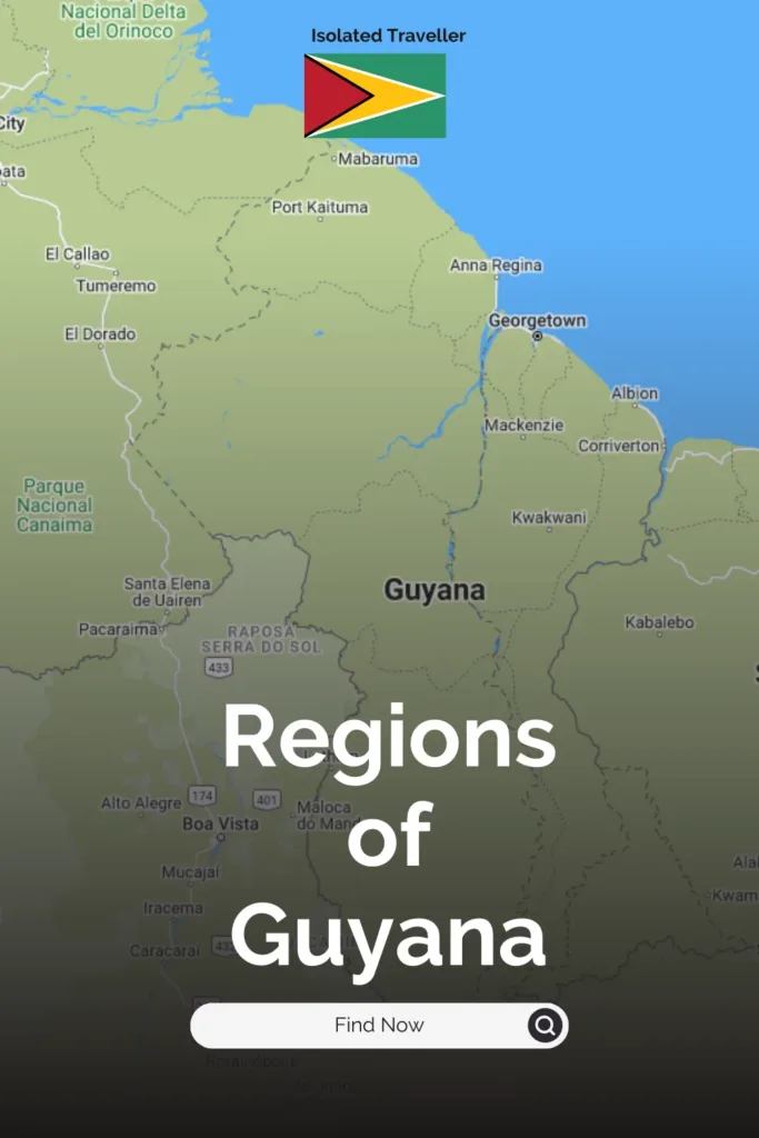
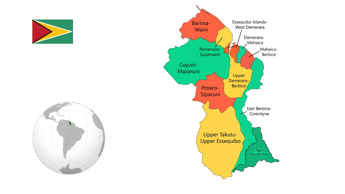
Guyana is situated on the northern coast of South America and is divided into ten administrative regions.
10 Administrative divisions: Barima-Waini, Cuyuni-Mazaruni, Demerara-Mahaica, East Berbice-Corentyne, Essequibo Islands-West Demerara, Mahaica-Berbice, Pomeroon-Supenaam, Potaro-Siparuni, Upper Demerara-Berbice, Upper Takutu-Upper Essequibo.
Georgetown, the capital city, is not part of any region but is a separate administrative unit known as the Capital City District.
List of Regions of Guyana
- Region 1: Barima Waini
- Region 2: Pomeroon-Supenaam
- Region 3: Essequibo Islands-West Demerara
- Region 4: Demerara- Mahaica
- Region 5: Mahaica-Berbice
- Region 6: East Berbice – Corentyne
- Region 7: Cuyuni-Mazaruni
- Region 8: Potaro-Siparuni
- Region 9: Upper Takutu- Upper Essequibo
- Region 10: Upper Demerara-Upper Berbice
Each region is further divided into neighbourhoods or communities.
The existing regional framework was instituted through the enactment of the Local Democratic Organs Act in 1980. The use of hyphenated names reflects the rivers that serve as the defining boundaries for each region.
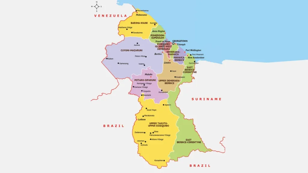
Guyana Regions
Region One – Barima Waini
The name of the Barima-Waini region derives from its two principal rivers. The region is predominantly forested highland, bordered at the north by a narrow strip of low coastal plain.
Region Two – Pomeroon-Supenaam
The Pomeroon-Supenaam region encompasses both forested highlands and low coastal plains, along with a minor segment of the hilly sand and clay terrain.
Region Three – Essequibo Islands-West Demerara
The Essequibo Islands-West Demerara Region comprises the islands within the Essequibo River, such as Leguan and Wakenaam, as well as the western segment of mainland Demerara. It encompasses low-lying coastal areas, hilly terrain consisting of sand and clay, and a limited portion of forested highlands.
Region Four – Demerara- Mahaica
The Demerara-Mahaica Region stretches from the eastern bank of the Demerara River to the western shores of the Mahaica River. Its predominantly a low coastal plain, with a small portion of the hilly sand and clay region further inland.
Region Five – Mahaica-Berbice
The Mahaica-Berbice Region spans from the eastern bank of the Mahaica River to the western edge of the Berbice River. The majority of the region consists of low-lying coastal plains, while inland areas feature Intermediate Savannahs and hilly sand and clay terrain.
Region Six – East Berbice – Corentyne
The East Berbice-Corentyne Region stands out as the sole region encompassing portions of all four natural geographic zones: coastal plains, intermediate savannahs, hilly sandy clay areas, and forested highlands.
Region Seven- Cuyuni-Mazaruni
The Cuyuni-Mazaruni Region encompasses two of the four natural regions: the forested highlands and a limited area of the hilly sand and clay region.
This region is notable for the awe-inspiring Pakaraima mountain range, which includes Mount Roraima
Region Eight – Potaro-Siparuni
The Potaro-Siparuni Region derives its name from the Potaro and Siparuni Rivers, both of which are tributaries flowing into the Essequibo River. The region boasts renowned natural wonders such as the Kaieteur and Orinduik Falls. Kaieteur is among the world’s highest single-drop waterfalls.
Region Nine – Upper Takutu- Upper Essequibo
The Upper Takutu-Upper Essequibo region encompasses the Kanuku and Kamoa highlands along with the expansive Rupununi savannahs. Dividing the region, the forested Kanuku Mountains create a natural boundary. The northern savannahs cover an area of approximately 2,000 square miles, while the southern savannahs span 2,500 square miles.
Region Ten – Upper Demerara-Upper Berbice
The interior area of Upper Demerara-Upper Berbice is predominantly characterized by the extensive hilly sand and clay region, housing Guyana’s primary bauxite reserves, notably concentrated in the White Sands area.
Guyana Regions Statistics
| Region | Regional Capital | Area (Square kilometre) | Population |
|---|---|---|---|
| Barima-Waini | Mabaruma | 20,399 km² | 26,941 |
| Pomeroon-Supenaam | Anna Regina | 6,195 km² | 46,810 |
| Essequibo Islands-West Demerara | Vreed-en-Hoop | 3,755 km² | 107,416 |
| Demerara-Mahaica | Triumph | 2,232 km² | 313,429 |
| Mahaica-Berbice | Fort Wellington | 4,190 km² | 49,723 |
| East Berbice-Corentyne | New Amsterdam | 36,234 km² | 142,839 |
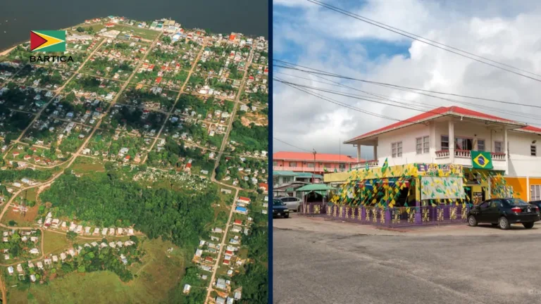
| Cuyuni-Mazaruni | Bartica | 47,213 km² | 20,280 |
| Potaro-Siparuni | Mahdia | 20,051 km² | 10,190 |
| Upper Takutu-Upper Essequibo | Lethem | 57,750 km² | 24,212 |
| Upper Demerara-Berbice | Linden | 17,040 km² | 39,452 |
| Capital City | Georgetown | 70 km² | 118,363 |
